From Launch Pad to Machine-Learning Pipeline
On January 30, 2026, a Long March-2C rocket lifted off from the Jiuquan Satellite Launch Centre carrying ALSAT-3B — the second of two Algerian earth-observation satellites launched within fifteen days. ALSAT-3A had gone up on January 15. The pair were built and launched under a contract signed with China in July 2023, covering satellite development, ground systems, training, and ongoing support.
Both satellites occupy sun-synchronous orbits and deliver high-resolution optical imagery. More important than the hardware itself is what the imagery feed enables: a near-continuous, structured data stream over Algerian territory that can be ingested directly into computer-vision and machine-learning pipelines.
This matters because Algeria’s two core economic pressure points — agricultural productivity and urban-sprawl management — are exactly the domains where satellite-fed AI delivers the clearest, fastest return. The raw imagery is not, by itself, an AI product. But feeding it through modern vision models transforms it from a passive record into a live operational intelligence layer.
According to Space in Africa’s analysis of Africa’s satellite fleet, the ALSAT-3A/3B launches push Africa’s total on-orbit count to 68 satellites, with Algeria now operating one of the continent’s more capable earth-observation constellations. The pair were developed through the Algeria-China contract signed in July 2023, as Connecting Africa reported following the ALSAT-3B launch on January 30, 2026.
The Three AI Use Cases That Are Ready Now
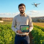
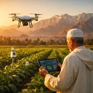
Crop-Yield Forecasting and Precision Agriculture
Algeria imports roughly 45% of its cereal needs annually — a structural vulnerability that the Ministry of Agriculture has acknowledged as a strategic risk. Satellite-based yield forecasting directly attacks this problem.
The workflow is well-established: multispectral imagery from successive passes is fed into vegetation-index models (NDVI, EVI) which detect crop health, irrigation stress, and probable yield weeks before harvest. Machine-learning models trained on historical ground-truth data then translate index patterns into per-field yield estimates.
The key barrier has historically been imagery availability and cost. With ALSAT-3B providing Algerian-territory coverage without per-image licensing fees to foreign vendors, the data-acquisition bottleneck disappears. The Agricultural Technology Institute (ITAF) and regional directorates of the Ministry of Agriculture are the natural institutional anchors — they hold historical ground-truth crop data that is needed to calibrate yield models.
Startups in the SAAT (Startup Algeria Agricultural Tech) cohort already experimenting with drone-based imagery analysis can migrate their models upward to satellite scale. The infrastructure cost to build a minimum viable crop-forecasting service — cloud compute, an open-source computer-vision stack, and ALSAT imagery access — is well within reach of a seed-stage team.
Illegal Construction Detection and Urban-Sprawl Monitoring
Algerian urban peripheries — particularly the wilaya rings around Algiers, Oran, and Constantine — have experienced rapid informal construction that outpaces planning and permitting systems. Manual inspection cannot keep pace with sprawl rates.
Change-detection algorithms applied to successive satellite passes solve this at scale. The approach: take a baseline image of a parcel, compare it with the next pass using pixel-level differencing or a neural network trained on “changed / not changed” labels. Deviations above a threshold trigger a flagging alert routed to the local Urban Planning Directorate (DUC).
Research on VLM-based urban defect detection demonstrates that vision-language models can now go beyond binary change detection to generate natural-language descriptions of what changed — “new concrete slab 400m² detected, northeast corner of parcel, estimated construction date 30-60 days ago.” This eliminates the manual review layer for straightforward cases.
The Ministry of Housing and Urban Development has an explicit mandate to enforce the Land-Use Coherence Plans (PDAU). ALSAT imagery fed into a change-detection pipeline would give PDAU enforcement teams a real-time audit layer they currently lack entirely.
Urban Flood Modeling and Disaster Risk Reduction
Algeria loses approximately 3-5% of GDP annually to weather-related agricultural and infrastructure damage, according to government risk assessments referenced in the National Civil Protection plan. EcofinAgency’s coverage of Algeria’s dual satellite acceleration program notes that disaster prevention and mitigation are explicit design objectives of both ALSAT-3A and ALSAT-3B. Flash floods, particularly in northern wilaya during October-March, are the dominant driver.
Satellite-derived digital elevation models (DEMs) and land-cover maps — both producible from ALSAT imagery — are foundational inputs for flood-risk models. Combining them with rainfall forecasts produces inundation maps that allow civil protection teams to pre-position resources and warn downstream communities.
The Civil Protection Directorate (DGPC) currently relies on hydrological models built from imported geodata. Domestic satellite imagery allows those models to be updated continuously rather than refreshed every several years when a new foreign dataset is purchased.
Advertisement
What Algerian Institutions and Startups Should Do
1. Establish a centralized ALSAT data-access protocol within ASAL before the end of 2026
The Algerian Space Agency (ASAL) operates the ground segment that receives and processes ALSAT imagery. The immediate gap is access policy: there is no published API, no open-data portal, and no defined licensing framework for startups and universities to use ALSAT data for commercial R&D.
ASAL should model its access regime on ESA’s Copernicus program, which provides free, open access to Sentinel imagery via a documented API. A tiered system — free for academic and government use, licensed for commercial derivatives — would unlock the ecosystem while preserving ASAL’s ability to monetize premium analytics products. Without this, ALSAT’s potential sits locked in a government silo.
2. Launch a geospatial AI challenge through the Startup Algeria program
The Ministry of Knowledge Economy (MTEIN) should issue a structured challenge — similar to the NASA Harvest program or ESA’s Phi-Lab competitions — inviting Algerian startups and university labs to build AI applications on ALSAT imagery. A prize pool of 50-100 million DZD (approximately $37,000-$74,000 at current rates) is sufficient to attract serious technical teams and produce deployable prototypes within six months.
This model is proven: ESA’s Phi-Lab competitions have produced commercial spinouts in crop monitoring, infrastructure inspection, and maritime surveillance. Algeria has the technical university base — USTHB, ENP, ESI — to generate competitive entries. The gap is institutional orchestration and data access, not talent.
3. Partner ALSAT analytics with existing government digital platforms
The Ministry of Agriculture’s AgriConnect platform and the Ministry of Housing’s PDAU management system are existing digital infrastructure that can consume geospatial intelligence as a data layer rather than requiring standalone products. Integrating ALSAT-derived analytics as enrichment layers into these platforms — rather than building separate dashboards — accelerates adoption because the end-users (agricultural engineers, urban planners) already work inside these systems daily.
The National Agency for Land Management and Planning (ANDT) is the natural integrator: it coordinates both agricultural land-use data and urban planning records and already has GIS capacity.
Where This Fits in Algeria’s 2026 Ecosystem
ALSAT-3B does not arrive in isolation. It lands inside an ecosystem that is, for the first time, developing the institutional scaffolding to use it. Algeria’s national AI strategy, unveiled at the 3rd African Startup Conference in Algiers in December 2025, targets six priority sectors for AI deployment, with agriculture and urban management both explicitly listed. As EcofinAgency reports on Algeria’s AI strategy launch, the country ranks 120th globally on the Oxford Insights Government AI Readiness Index 2023 — scoring 35.99 out of 100 — a baseline that reflects the starting point, not a ceiling.
The satellite gives Algeria a data asset that most African countries do not have: domestic earth-observation coverage that is not subject to foreign-vendor access restrictions, pricing changes, or geopolitical supply disruptions. What Algeria must now build is the software and institutional layer that converts imagery into decisions.
The gap between a satellite in orbit and an AI product in production is a software engineering and institutional design problem — both of which are solvable. The ALSAT-3A/3B constellation gives Algeria’s tech ecosystem a rare first-mover advantage on the African continent: a domestic imagery feed, a growing AI startup base, and a government that has explicitly signaled intent to connect them. The window to establish that connection before foreign competitors (who are already selling satellite-AI services across North Africa) dominate the market is approximately 18-24 months.
Frequently Asked Questions
What resolution does ALSAT-3B provide, and is it sufficient for AI applications?
ALSAT-3B delivers high-resolution optical earth-observation imagery from a sun-synchronous orbit, designed to support land-use planning, disaster prevention, and environmental monitoring. While the publicly disclosed specification does not give an exact sub-metre number, the satellite class and the Algeria-China contract specifications place it in the category usable for crop-parcel-level analysis and building-footprint detection — both sufficient for the AI use cases described in this article. Comparable satellites in its class typically achieve 0.5-1.5 metre panchromatic resolution.
How can an Algerian startup access ALSAT imagery today?
Currently, ALSAT data is managed exclusively by the Algerian Space Agency (ASAL) with no published open-access portal or startup API. Access requires a formal request to ASAL’s applications division. This is the primary bottleneck: the article’s core recommendation is that ASAL publish a structured access framework — free for academic/government use, licensed for commercial use — modelled on ESA’s Copernicus open-data program.
Which Algerian universities have geospatial AI research programs that could leverage ALSAT data?
The University of Science and Technology Houari Boumediene (USTHB) in Algiers has an active remote-sensing and GIS research group. The National Polytechnic School (ENP) runs programs in signal processing and earth observation. The Higher National School of Computer Science (ESI) has machine-learning research capacity. All three are positioned to participate in a government-sponsored geospatial AI challenge using ALSAT imagery as the input dataset.
Sources & Further Reading
- Algeria Launches ALSAT-3A, Next-Generation Earth Observation Satellite — Space in Africa
- Algeria Launches Second Satellite in 2026 — Connecting Africa
- InfraGPT: VLM-Based Framework for Detecting Urban Defects — arXiv
- Algeria Accelerates Space Program with Two Satellite Launches — EcofinAgency
- Algeria Unveils AI Strategy to Boost Digital Transformation — EcofinAgency
🔗 Related Intelligence

Alsat-3A and Alsat-3B: The New Data Pipeline for Algerian AI

Algeria’s InnovAgro: The EU-Backed Agritech Accelerator Betting on Drone AI and Precision Farming

Algeria’s AI Strategy Refresh: Three Operational Pillars Become the Plan
Smart Agriculture in Algeria: Can AI Feed 47 Million People More Efficiently?